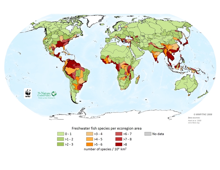
The map of number of freshwater fish species/ecoregion area (in essence, species richness adjusted for ecoregion size) was generated by querying a database constructed for this project. We provide this map in addition to that of fish richness to highlight those ecoregions with a disproportionately large number of species for their area. Fish data came from a variety of sources. For the United States, distribution data in the form of species assignments to 8-digit HUCs (hydrologic unit codes) were provided by NatureServe, and these were aggregated to freshwater ecoregions. For some small islands, species lists were generated using FishBase and then were augmented where possible with information from published literature. For most other ecoregions, species lists were provided by experts. For a small number of species it was impossible at this time to generate species lists, and endemism estimates are provided instead; these ecoregions are shown with hatching. The numbers shown in this map represent only species using freshwater for at least a portion of their life cycles. These species were identified using the habitat assignments in FishBase. Extirpated species are included in these tallies, but resolved extinct species, as determined by the Committee on Recently Extinct Organisms (data provided by Ian Harrison), are excluded. Introduced species are not counted.

Freshwater fish species per ecoregion area